Shawnee Indians
A monument commemorates their departure in Hardin
The Shawnee Indians, also of Algonquian stock, lived in the east and Midwest. Their first contact with white men came in the 1600s. Early estimates of their population range from 3,000 to 50,000, although 10,000 appears to be the most probable estimate. Shawnee comes from the Algonquian word ‘Shawun’ (shawunogi) meaning ‘southerner.’ The application of southerner is indicative of their location vis-a-vis the other Algonquian tribes who lived to the Shawnee’s north, around the Great Lakes. A symbol of the Shawnee authority is the eagle feather headdress.
During the 1600s, they were forced to leave their traditional lands, including the Ohio Valley, by the marauding Iroquois during the Beaver Wars. In the 1700s, they once again began to call the Ohio Valley their home, settling initially along the Ohio River where conflict with white settlers became a routine occurrence. Allying themselves with the British during the Revolutionary War, combined with being absolutely against white expansion beyond the Appalachian Mountains, did not endear them to the Americans. Led into battle by Chief Cornstalk, they were severely defeated by colonial troops in 1774 in the area of Point Pleasant, West Virginia.
The loss resulted in a split in the Shawnee tribe that caused many of them to move west beyond the Mississippi River. Those that stayed behind in Ohio rallied behind Tecumseh until the 1811 Tippecanoe defeat and the death of Tecumseh in Canada during the War of 1812.
The Shawnee village of Piqua (Piquea), located four miles southwest of Springfield, Ohio, was attacked by American soldiers under the command of General George Rogers Clark on August 8, 1780. It was a ferocious battle that ended with the total destruction of the Shawnee village, and their agricultural crops.
Seeking a new area in which to build a village, the Indians traveled northwest until they reached the Great Miami River where they chose a location on the west side of the river, just north of where the Johnston Indian Agency would eventually be constructed. They named this new village, upper Piqua. The Miami Indians village of Pickawillany, along with Fort Pickawillany, was at this same site until it was abandoned in 1763 after an earlier unsuccessful attack by the Shawnee.
At the same time, they established another village in the area, on the east side of the river, on a site that is now occupied by the city of Piqua. The Shawnee named this second village lower Piqua. They had lived in the Piqua area for two years when, in 1782, General Clark and 1,000 Kentuckians moved north into Ohio. The Shawnee decided to abandon their Piqua villages without a fight and moved to a location on the Auglaize River. After the Greene Ville Treaty was signed, they moved back to the area, locating villages in Wapakoneta, north of the new treaty line, Hog Creek (southwest part of Lima) and Lewistown.
In 1832, they ceded the last of their Ohio lands to the government, and in a sorrowful procession through Hardin, Piqua, Greenville and Richmond, the last of the mighty Shawnee rode their horses to a new home in eastern Kansas.
Today, most of the Shawnee live in Oklahoma or have merged into this region’s population. A monument can b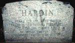 e seen today in the small park area in Hardin, six miles west of Sidney, at the intersection of State Route 47 and Hardin-Wapak Road. It is located on the southeast corner of the park. This monument commemorates not only the killing of Colonel Hardin by the Indians, but also marks the spot where the Shawnee camped in October, 1832, on their last trek from Ohio.
e seen today in the small park area in Hardin, six miles west of Sidney, at the intersection of State Route 47 and Hardin-Wapak Road. It is located on the southeast corner of the park. This monument commemorates not only the killing of Colonel Hardin by the Indians, but also marks the spot where the Shawnee camped in October, 1832, on their last trek from Ohio.
'Indian' segment written in December, 1997 by David Lodge
Piqua Shawnee
Piqua Shawnee Tribe
No comments:
Post a Comment
Note: Only a member of this blog may post a comment.